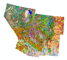
The Southwest Regional Gap Analysis Project (SWReGAP) was initiated in 1999 as a multi-institutional cooperative effort to map and assess biodiversity for a five-state region (AZ, CO, NV, NM, UT) comprising approximately 560,0002 miles in the southwestern U.S.
A key task was the development of a seamless landcover map for the region and the collection of other pertinent bio-physical spatial data. Through coordination from the U.S. Geological Survey’s Gap Analysis Program (GAP) and the collaborative efforts of participating state institutions, a seamless landcover product was completed in September 2004. These data and related datasets are made available to the public by the SWReGAP consortium of institutions responsible for their development.