Recently (September 2015) the U.S. Department of Interior announced that the U.S. Fish and Wildlife Service has decided the greater sage-grouse (Centocercus urophasianus; sage-grouse), an iconic bird in Western America, does not need protection under the Endangered Species Act. Local stakeholders, federal, and state agencies have worked together in an effort to maintain a healthy sagebrush (Artemisia spp.) landscape as habitat required by sage grouse.
By using the best available technology and science to monitor greater sage grouse populations land managers can better assess the impacts of management decisions. Having precise counts of sage grouse lek attendance, and specifically male lek attendance, is an important metric used to evaluate population health (Gifford et.al, 2013, Dahlgren et al., 2016). A lek is a seasonal breeding site where males preform a ritualistic courtship dance for females. As in many research and management disciplines, it is important to have tools that are precise, non-invasive, and cost effective.
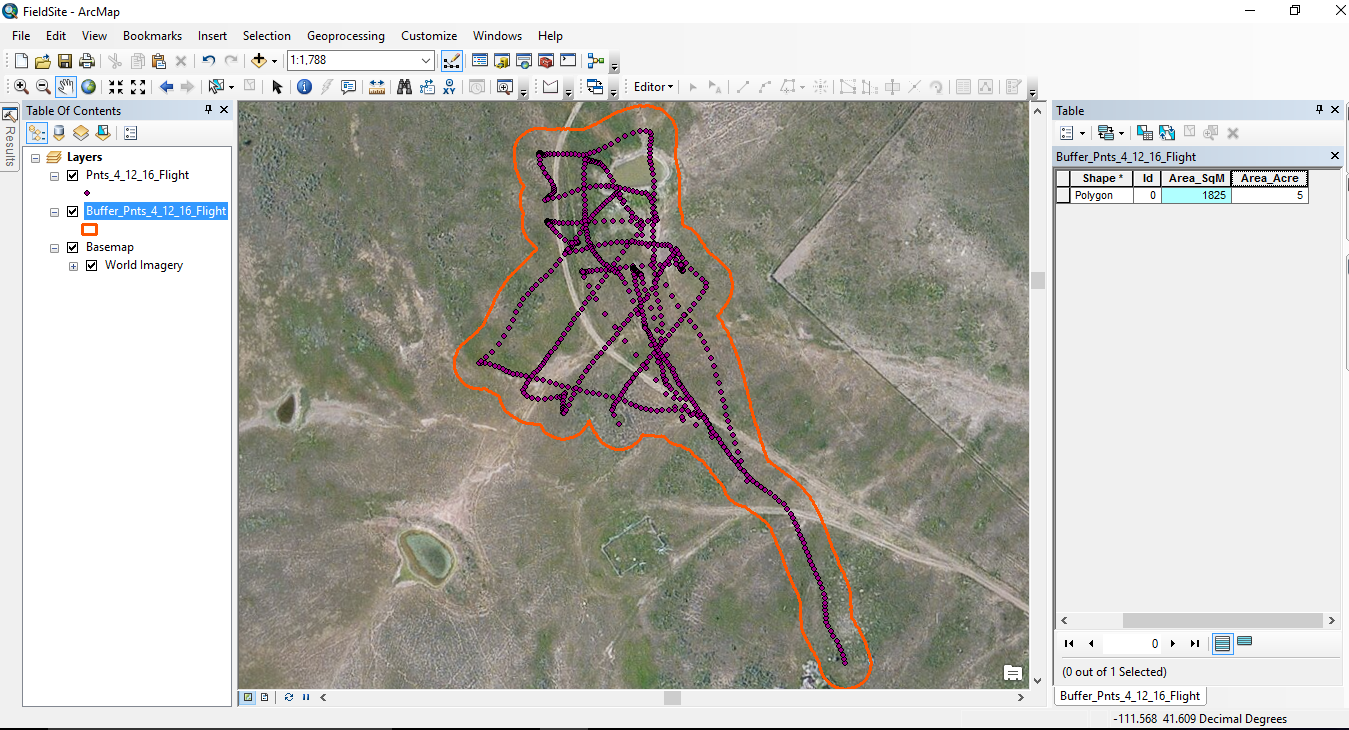
This study examines whether a Remotely Piloted Aircraft (RPA) can be an effective tool in detecting, and therefore counting, greater sage grouse during lek season. More specifically, this research examines the use of a Forward Looking Infrared (FLIR) camera to detect sage-grouse in and around known leks. By acquiring aerial imagery over an active lek, we have a snapshot in time, where sage grouse counts can be digitally and/or visually assessed. For this research a combination of image processing, geographic information systems (GIS), and point cloud software will be used to count individual birds. Using state of the art technology to obtain accurate sage grouse lek attendance counts can help managers and scientists better understand lek attendance and lek population dynamics. Further, results of this study will also provide a guideline for the use of RPA’s to monitor sage grouse.